experience
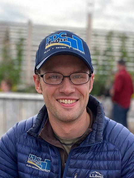
John is a licensed and practicing surveyor in Alaska and is also licensed in Kentucky. John was born and raised in Alaska, and has spent the majority of his life in “the last frontier”. Like many Alaskans, John takes advantage of the endless opportunities that the Alaskan wild has to offer, which made land surveying an easy career choice. He is a husband, father of 3 children and in his spare time enjoys playing hockey, riding snow machines (snowmobiles), boating, hiking and fat tire bikes.
How did you become interested in surveying, specifically your work with drones?
I started out as a civil engineering major and was not enthused with my classes. I took a surveying class and then moved to Anchorage, Alaska, for my wife to pursue her nursing degree. This is when I decided to give geomatics a try. I was immediately engaged and interested in all of my classes and everything geomatics had to offer. I loved it all and tried hard to gain real-world experience in as many different nuances and sub-disciplines within geomatics that I could. By the time I graduated with my bachelor’s degree, I had worked for a small survey shop, the State of Alaska Department of Transportation and Public Facilities, an aerial mapping firm, and a large engineering design firm. Even as I settled into working mostly design surveying, remote sensing was always a top interest of mine.
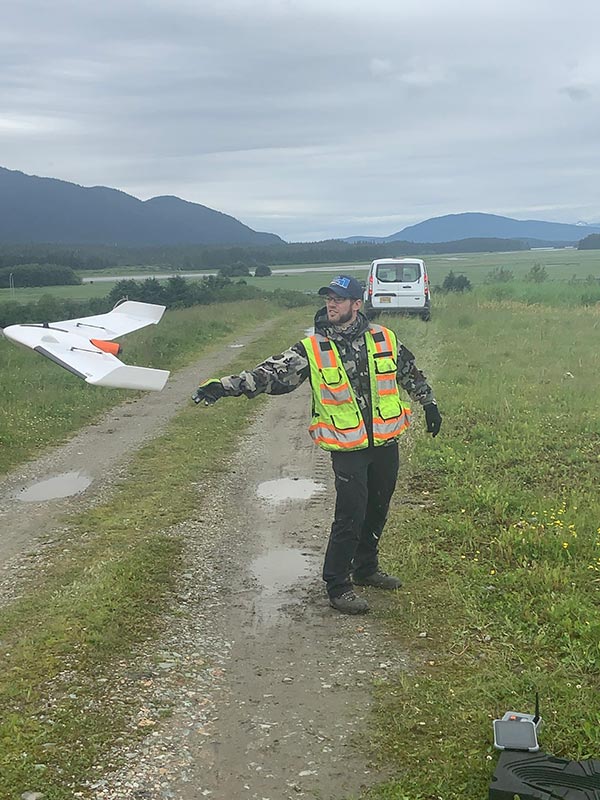
When drones started to become more of a big deal back in the mid 2010s, I began looking into it and quickly discovered that it would be quite useful to surveying and other professions, as well. When the Federal Aviation Administration’s Part 107 Certificate became available in August 2016, I jumped at the chance to get certified. I have now renewed my certificate twice and what has happened over the last five years for drones, within and outside of surveying, has been amazing. I have been flying them since 2015 and been working to continuously figure out new ways to use them within the architecture, engineering, and construction industry. Thus far into 2020, I have spent 30 percent of my professional time on drone-related work and activities.
How are changes in technology affecting the surveying profession?
Just because the technology changes, doesn’t mean we necessarily change our primary role as surveyors. Clients still want existing conditions measured, grades staked, parcels subdivided, corners set, boundaries determined, etc. We use drones, scanners, sonar, GPS, total stations, levels, and basic survey equipment throughout our field season in Alaska. The technology ultimately allows a surveyor to get more data in less time, and as we all know, time is money. The biggest change I have seen with technology is the evolution of survey crews and office personnel. It now takes less people to acquire the same data, or in some cases more of it. In Alaska, two-person crews are sometimes a must because of safety, but even here one-person crews are not uncommon for certain jobs. Not only does it take fewer people, but one person can now shorten the time on a task exponentially due to the technology available.
What advice would you give those who are thinking of becoming licensed in multiple states?
When I told my dad that I had passed all the exams to be licensed as a land surveyor in Kansas, he was excited and congratulated me. He then went on to tell me, “Now they can take it from you, so be careful.” His next sentence was, “Get licensed in all states you are thinking of potentially working in because once your references have retired or passed away, it becomes harder to get that engineering and land surveying license.” So, my advice to individuals who are thinking of becoming licensed in multiple states is to take a step back and make a list of potential states they think they might want to get licensed in, think about where they currently live and where they think they might want to live in the future, think about their position within their organization and what their workload (design, management, etc.) is, and then apply for the licenses including those that might require additional education, an additional exam(s), etc. I do caution individuals who are licensed in multiple states because laws, rules, continuing education, etc. vary from state to state, so be aware of what each state and each state’s professional license requires from the licensee.
How do you continue to learn in order to stay on top of the new trends and technologies within your role? What resources have helped you along the way?
My job as a county engineer entails planning, coordinating, allocating, and supervising the engineering and construction assignments associated with the maintenance and repair of the secondary road system; preparing the annual budget and administering the funds for the secondary road system in accordance with the Iowa DOT specifications; overseeing the design, planning, and priority setting for all road, bridge, and culvert work; preparing plans and estimating and advertising letting information for construction projects; supervising and inspecting all construction and maintenance work and ensuring its economical and efficient performance; establishing departmental personnel policies and making the final staffing decisions; performing public relations work within the community and the state; consulting with the public concerning problems or complaints; and consulting with and working under the direction of the county board of supervisors.
I work on projects ranging from repairing/replacing culverts of all sizes, repairing/replacing bridges of all sizes, repairing/replacing paved roads, and working with landowners on situations involving the county, the state, and the federal government.
As a dual licensed individual, I can work in both capacities as an engineer and a surveyor on any given project. Most projects require the county to have a good idea of where the road right-of-way is prior to commencing construction activities, so that is where being a surveyor is beneficial. I am also able to author property descriptions for right-of-way acquisition and disposal as well as for the creation of an easement or vacation of an easement.
How are professional surveyors critical to protecting the safety of the public?
Our first priority isn’t to our clients or ourselves, but to the public. That mindset is essential for a professional land surveyor, but I will admit that sometimes it is hard to think about while slogging through some of the more mundane tasks of the job. Some great examples are for utility and transportation ROWs since those serve the public at large. If we screw up, then it affects everyone. For example, the engineer may not have the right data to properly design a bridge or a subdivision could be ruined for many people because of improper surveying methods. We are critical to the determination of boundaries and existing conditions for a multitude of projects. It is our duty to be as thorough and detail oriented as possible to protect the public, whether that is just a couple of people at a point in time or the public at large. There really is quite a fine balance, and a professional surveyor needs to have the intuition to determine the amount of liability to the public different jobs can have.

Why should someone pursue getting their P.S. license?
The average age of surveyors is so high, so job security is a great reason right now. In some states, such as my home state of Alaska, it is illegal to map (including with drones) unless you are a licensed land surveyor from the state of Alaska. You get more responsibility with a license, the pay is usually higher, and it is a good career move. I just really wanted that license as soon as I learned it was important to surveying in Alaska. Having the license in my pocket has opened a lot of doors that would not have been available without it. I would recommend that path to anyone in surveying, though I recognize it is not a path for everyone. There is a lot of responsibility that comes with holding such a license.
What are your thoughts on the future of surveying? What opportunities and challenges do you foresee?
So many surveyors are retiring and with that goes all of their knowledge and wisdom, but it also presents a multitude of possibilities for the rest of us. Hopefully, we can glean that knowledge and wisdom from these seasoned surveyors that are retiring, pair it with the continuously changing technology, and keep our profession running strong, even with fewer people in it.
Most states now require a four-year degree to become a licensed surveyor, and that is a big barrier for a lot of people. There has been a debate for a long time regarding which way we should go as a profession. Should we be like the trades and allow past work to determine qualifications for licensure? Should we go the route of the engineers and require the degree? Right now I understand that most states require the degree, but that could change in the future based on economic demands. We have to adapt to the times we are living in. How we as surveyors adapt will determine how our profession continues on. I find myself on the degree or no degree sides of the coin depending on the day. I don’t know if there is a right answer and, personally, I haven’t decided to throw my hat in one ring or the other. I do know that we need to focus on ourselves and not be negatively influenced by other professions in how we approach our problems and obstacles.
Another challenge that I see many surveyors facing is a constant effort to compare surveying to other professions, specifically engineers. I believe how we handle that in the future is a big deal. My personal opinion is that we are a unique and valuable profession. We are not engineers and shouldn’t be comparing ourselves to them. We, as a profession, have the power to influence other professions in how they view us. I can’t think of a single profession that surveying should be compared to, as it would be comparing apples to oranges. The opportunities for us will align with federal and state statutes as the law is the only difference between the public choosing us rather than, for example, someone who acquired a drone and now offers “surveys.” The public will always choose the cheaper option, though there are always exceptions, and it is up to us licensed surveyors to continue to show the value in having those statutes to aid and protect the public.
One future possibility I am excited about is surveying space, moons, and planets! As time goes on, the name of geomatics may need to change because honestly “surveyor” is just a term for “location expert.”

