experience
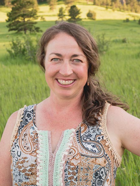
Kayce Keane started her career in 2003 on the back of her bachelor of science degree in applied mathematics (concentration in physics with a minor in astronomy). After graduation, she began practicing land surveying in western North Carolina. She then took over 30 hours of coursework from the ABET-accredited surveying and mapping science program at East Tennessee State University (2004–05). This coursework expedited earning a license in North Carolina in the spring of 2007. Upon moving to Boulder, Colorado, she attained her surveying license in Colorado (2009) as well as Wyoming (2012). In 2012, she received a master of science in geographic information science.
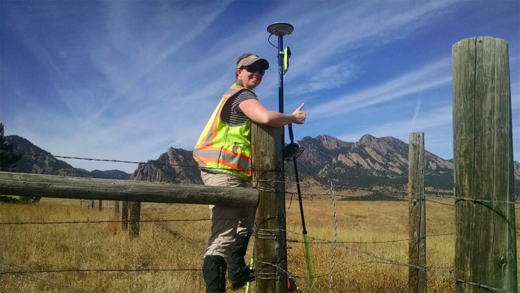
Her experience includes working on the Colorado Department of Transportation Right-of-Way plans, mineral surveys, bathymetric surveys, windfarm projects, ALTA/NSPS Land Title Surveys on private commercial and state-owned properties, and boundary surveys large and small.
Since 2008, Keane has served the Colorado land surveying community through the following establishments:
- Colorado State Board of Licensure for Architects, Professional Engineers, and Professional Land Surveyors—board officer.
- National Council of Examiners for Engineers and Surveyors—Colorado delegate and member.
- Rocky Mountain Surveyors Summit Committee—chair.
- Professional Land Surveyors of Colorado (PLSC)—former board vice president, former board director, former legislative committee member, and former northern chapter president.
- GIS in the Rockies—former board director and former committee member.
Keane has written a handful of articles for the Colorado Publication ‘Side Shots’. She has received awards from PLSC for her dedication to the profession including Surveyor of the Year in 2020. Lastly, she has won several plat contests at the statewide conference for her submitted maps.
Presently, Keane is the director of surveys for Boulder Land Consultants, Inc, a surveying company in Boulder, Colorado.
In her free time, she enjoys skiing, mountain climbing, mountain biking, camping, gardening, and spending time with her incredible family (two beautiful fun little girls and a loving supportive husband).
Tell us about your background and how you became interested in surveying.
I grew up in western North Carolina as a mountain girl who loved the outdoors. In high school, I discovered that I excelled in formal and natural science. I am a true composite of my parents: my mother, the nature lover, and my father, the scientist.
In college, I studied hard sciences as that’s where my interests were. Once I received my degree, I wasn’t sure what career path to take. Lucky for me, my then new stepfather, Ron Kirkland, was a professional land surveyor. After graduating college and while on my summer hiatus, I visited my family. He suggested that I participate in a surveying project. After spending a day in the field, I blasted him with questions. I just couldn’t believe that people were paying us to hike around the woods looking for old monuments while making measurements. I was instantly hooked and landed my first land surveying job in Boone, North Carolina.
I believe that land surveying best suited for those who love the intersection of science and the outdoors.
Why did you pursue getting your P.S. license? How has it affected your career?
As soon as I got into surveying, I immediately realized that obtaining my P.L.S. was a high priority. After working in land surveying for a year, I determined that I needed some college courses directly related to land surveying to obtain my license expeditiously. I attended East Tennessee State University and I took 33 hours of surveying courses in a year. Once this was under my belt, I knew that I would likely be able to get my license in any state I wanted, assuming I passed the licensure exams.
Obtaining my license signals to my peers that I am a bonafide and committed surveyor. It has also given me more opportunity. Signing off on my own work is a point of pride. In my region, I hope to create a long-lasting positive legacy of high quality and comprehensive boundary surveying that my peers (and future surveyors) are happy to incorporate and rely on.
How do you continue to learn in order to stay on top of the new trends and technologies within your role? What resources have helped you along the way?
My method of staying on top of new trends and technologies is by volunteering for my surveying community. Being engaged in this way helps support Colorado surveyors, promote professional relationships, and places me in a position to learn about new trends and technologies from my peers.
For example, I am presently the chair of the Rocky Mountain Surveyor Summit. By planning this event, I hear from other leaders in the state about what they think is important. We have discussions on who to bring in to present and what subject matter the team thinks we should be highlighting. It’s a neat gateway for me to see what my competitors (and friends) see as important in our field.
During the event, I attend seminars with diverse experts speaking to new hardware and software, updates/upgrades in technologies, address looming datum changes, UAV, and GPS modernization. I am able to engage my local vendors to see what software and hardware updates are being made in my preferred survey brand. Asking questions about substantive changes in the equipment/software can play a big role in workflow, efficiency, and training. I am fortunate to have an excellent network of people I trust. If I want to know more about a particular technology, I can read about it on the internet. However, when you’ve engaged your surveying community, you can have a deeper dialogue and frank discussion with folks you know and trust. This is something the internet can’t provide.

How are professional surveyors critical to protecting the safety of the public?
Surveyors perform work regularly that helps protect the safety of the public. Two examples stand out: determining critical elevations on homes for elevation certificates or flood studies, and construction staking. Performing proper calculations in the office and laying them out accurately and precisely in the field can have massive impacts to the stability of the erected improvement (buildings, bridges, etc.).
In addition to protecting the safety of the public, we are poised to serve the public interest in a unique way. Our quasi-judicial role as surveyors allows us an unparalleled opportunity to serve the public in a distinctive way. No other profession can use legal principles like we can to resolve boundary conflicts.
You are a member of the Colorado board and therefore a member of NCEES. Can you give us some background into your participation as a member board member?
I joined the Colorado State Board of Licensure for Architects, Professional Engineers, and Professional Land Surveyors in the summer of 2019. It has been an excellent opportunity for me to learn more about the licensing procedures, rule-making processes, NCEES—as well as to see our government in action. It has been an honor to weigh in on important land surveying matters in Colorado. The Colorado board is in a unique position to help address matters by educating licensees and local governments, presenting at conferences and meetings, sending out newsletters and using the rule-making process to clarify and address professional standards. The purpose of the board is to protect and serve the public, and it is with this in mind that we make decisions and act as a board.
Tell us about the most memorable moment you had in your career as a licensed surveyor.
My most memorable moment in this profession was my first day surveying with my stepfather. There was as group of us hiking up this steep hillside in the Appalachian Mountains with our survey gear. Ron was charged with performing a boundary survey for the Forest Service. I had no idea what was going on; I was just there to help carry equipment. About an hour or two into the day, he was staring at this big oak tree. He studied forestry, so I figured he was admiring the nature in front of him. Next thing I know, he takes out his bush axe and cuts a giant blaze into the tree, revealing scribing from over 100 years ago that monumented that tree as a property corner. As you might imagine, I was completely blown out of the water. This event changed the course of my future in a profound and meaningful way.

